Satellite-based Remote Sensing Survey of Late Holocene Settlement on Madagascar
Understanding the past requires a relatively complete and unbiased record of all previous human activity. Despite decades of archaeological research, approximately 75% of Madagascar’s landscape remains uninvestigated archaeologically, and the oldest sites on the island are difficult to locate, as they contain the ephemeral remains of mobile hunter/forager campsites. The goal of this study is to identify unrecorded cultural deposits and expedite survey procedures. Using theoretical models derived from human behavioral ecology in conjunction with freely available remote sensing data (Sentinel-2), we are aiming to develop a predictive model for identifying archaeological sites along the coastal regions of Southwestern Madagascar. This process will involve the use of machine learning algorithms to aid in image analysis procedures and GIS workflows. By targeting our model towards the earliest archaeological deposits on Madagascar, we hope to further current understanding about the earliest inhabitants of the island with respect to their timing of occupation and their relationship with their environmental surroundings.
This study will form the basis for future research concerning human-environmental interaction in prehistory as well as questions involved with the settlement history of Madagascar. Additionally, this research will represent one of the only studies conducted to date on Madagascar that utilize remote sensing technologies for archaeological investigations. This technology has yielded important information in other parts of the world, and will result in a greater understanding of landscape level patterns of human behavior in this region. By recording patterns of past human settlement and mobility strategies, we can investigate the circumstances that lead to people’s decisions to live in a particular place. This can aid contemporary communities in coping with harsh conditions (environmental, political, etc.) and inform conservation policies to protect important resources.
This research has been supported by a Seed Grant award from the Institute for CyberScience at the Pennsylvania State University, a Hill Fellowship Award through the Department of Anthropology at the Pennsylvania State University, the NASA Pennsylvania Space Grant Consortium, the American Philosophical Society, Explorers Club, and Sigma Xi.
Image Carousel with 6 slides
A carousel is a rotating set of images. Use the previous and next buttons to change the displayed slide
-
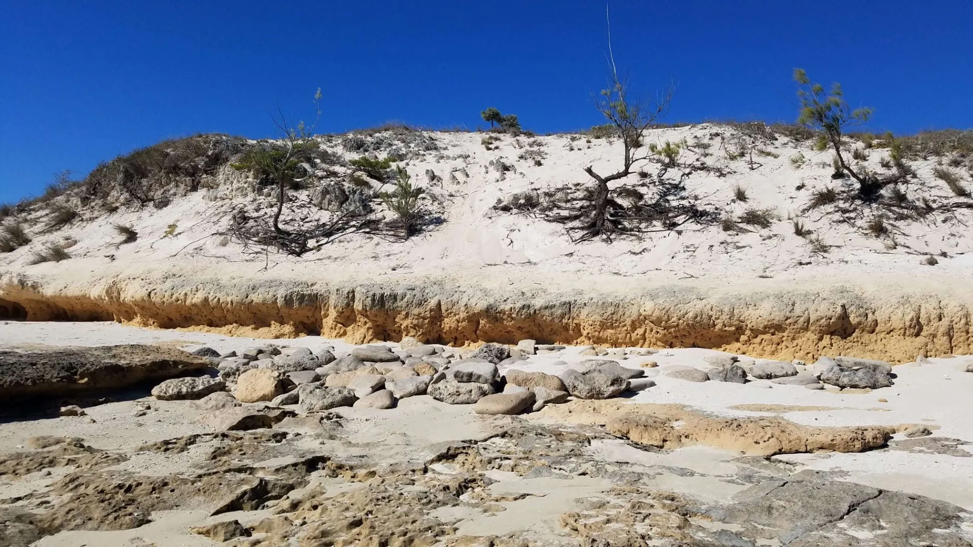
Slide 1: Survey of Late Holocene Settlement on Madagascar
-
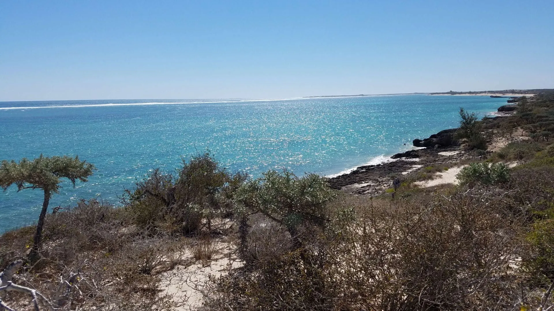
Slide 2: Survey of Late Holocene Settlement on Madagascar
-
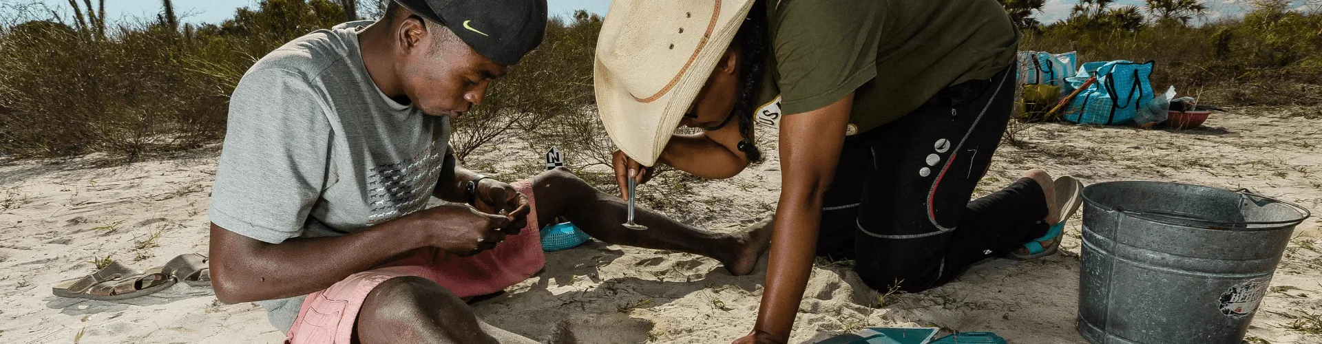
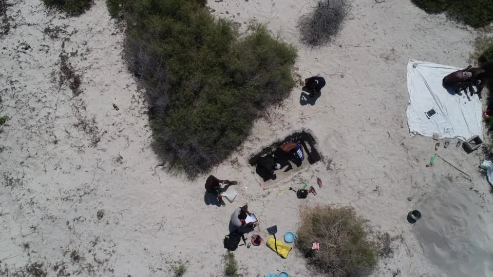
Slide 3: Excavations in Velondriake conducted by the M.A.P. team in 2020
-
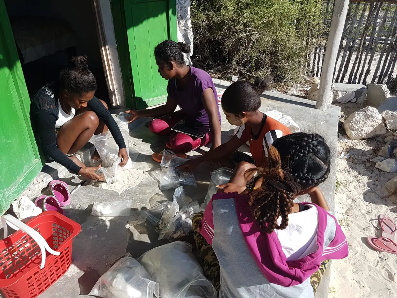
Slide 4: Sorting samples collected during survey work.
-
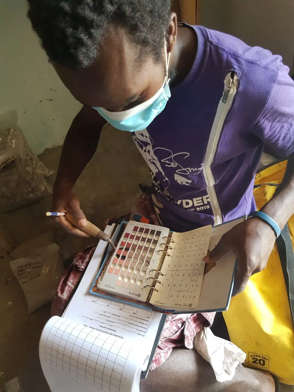
Slide 5: Data entry after surveys and excavations.
-
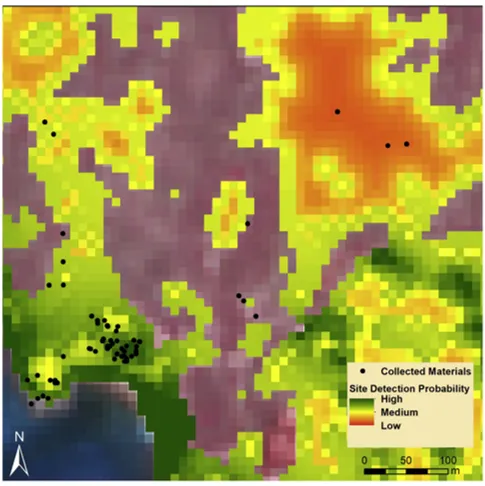
Slide 6: Predictive model for Velondriake, Madagascar
Products/Publications:
Predictive Model and associated data: Available here.
Spatial Point Process Modeling Procedure: R code available here.
Davis, D. S., Buffa, D., Rasolondrainy, T., Creswell, E., Anyanwu, C., Ibirogba, A., Randolph, C., Ouarghidi, A., Phelps, L. N., Lahiniriko, F., Chrisostome, Z. M., Manahira, G., & Douglass, K. (2021). The aerial panopticon and the ethics of archaeological remote sensing sacred cultural spaces. Archaeological Prospection, 28(3), 305-320.
Davis, D. S., R. J. DiNapoli & K. Douglass. (2020). Integrating Point Process Models, Evolutionary Ecology and Traditional Knowledge Improves Landscape Archaeology—A Case from Southwest Madagascar. Geosciences, 10 (8), 287.
Davis, D. S., V. Andriankaja, T. L. Carnat, Z. M. Chrisostome, C. Colombe, F. Fenomanana, L. Hubertine, R. Justome, F. Lahiniriko, H. Léonce, G. Manahira, B. V. Pierre, R. Roi, P. Soafiavy, F. Victorian, V. Voahirana, B. Manjakahery & K. Douglass. (2020). Satellite-based remote sensing rapidly reveals extensive record of Holocene coastal settlement on Madagascar. Journal of Archaeological Science, 115,105097.